
professional land surveyors


We Measure-Up To The Highest Standards

Locations
Providing exceptional service to our communities since 2005
Serving New York, New Jersey, Florida, and Arizona. Serving Architects, Engineers, Utilities, Constructions companies (Builders), Real Estate Attorneys, Construction and Insurance Companies across New York, New Jersey, Florida, and Arizona
Capabilities
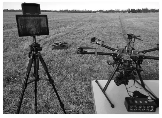
Multispectral Imaging
provides traditional land surveying services to our public and private sector clients. We employ the latest technology for field data collection, including GPS equipment, electronic data collectors, digital and auto levels, and total stations. With thirteen licensed professional land surveyors overseeing our teams of talented field crews and office staff, their broad knowledge and experience is applied to all projects. Our experience, responsiveness, and commitment to quality ensure the highest accuracy and on every survey.
Capabilities
Multispectral Imaging
provides traditional land surveying services to our public and private sector clients. We employ the latest technology for field data collection, including GPS equipment, electronic data collectors, digital and auto levels, and total stations. With thirteen licensed professional land surveyors overseeing our teams of talented field crews and office staff, their broad knowledge and experience is applied to all projects. Our experience, responsiveness, and commitment to quality ensure the highest accuracy and on every survey.

History
Providing exceptional service to our communities since 2005
Clearpoint Services was created in response to a growing need for customer friendly and cost-effective land surveying to services. For over 15 years our team of licensed personnel have been serving the needs of architects, engineers, Real Estate Attorneys, and Construction and Insurance Companies across New York, New Jersey, Florida, and Arizona.
We are proud to be recognized as a leading provider of professional surveying services. We are a company driven to be the best and that pushes us to continually apply new technologies and expand our industry knowhow to help our customers get the best possible service.
PROJECTS


Testimonials


NEWS

builder
builder
builder
clients


